"The Ships"
- featuring -
SKA 4 - page two - - incl. her sister ships, crew and Greenland -
")
SKA 3, -SKA 4, -SKA-5, -SKA 6 side by side in Sukkertoppen. (Photography by Karsten Petersen ©)
")
Niels trying to make new friends - (Photography by Karsten Petersen ©)
")
SKA boats, - through narrow channels on the way to the survey area - (Photography by Karsten Petersen ©)
")
At the survey area, - SKA 5 and behind SKA 3 - take note of the two rubber boats. They also carry echo sounders - (Photography by Karsten Petersen ©)
")
A closer view of a rubber boat with echo sounder equipment Peter navigating the boat, while Jan Walseth is in charge of the equipment - (Photography by Karsten Petersen ©)
")
SKA boat running aground - other SKA boats and rubber boats standing by - (Photography by Karsten Petersen ©)
")
SKA 6 (Photography by Karsten Petersen ©)
")
SKA 4 Engineer Karsten Petersen, - the web master - Greenland is GREAT! - But now, - please have a look inside a SKA boat! - (Photography: Unknown)
 (Photography by Karsten Petersen ©)")
SKA 4 - Jan and Jørgen in the main cabin - (The shot gun on the wall is NOT navy armament, but we used it for hunting.) (Photography by Karsten Petersen ©)
SKA 4
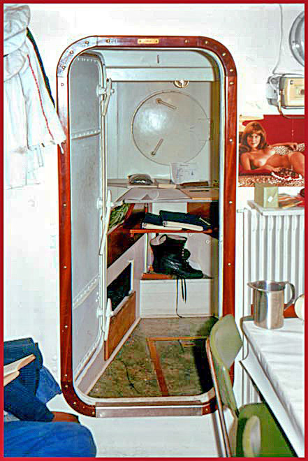
- a look into the forward cabin, - my cabin -, sharing with Jørgen.
Take note of the watertight door, that would save the ship if the forward compartment got water filled -
(Photography by Karsten Petersen ©)

SKA 4, - the forward cabin, and my room mate Jørgen reading a book, - very intellectual! The name of the book? "Death Drives Cadillac" (Photography by Karsten Petersen ©)
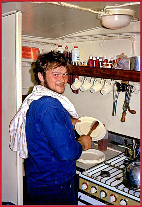
SKA 4's very small galley and Chief Cook - this is Peter,- professional sailor from Hirtshals -, now turned Cook on SKA 4 - (Photography by Karsten Petersen ©)
")
And here the wheel house of SKA 4 - the entrance to the main cabin is seen to the left - (Photography by Karsten Petersen ©)
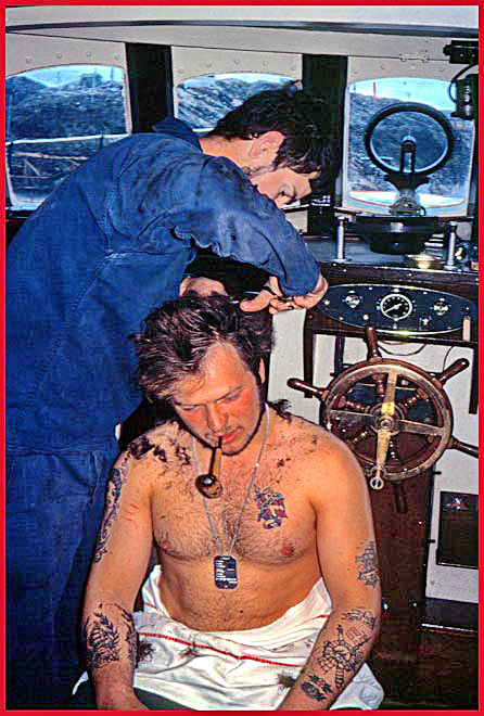
The wheel house also served as beauty parlor. -
SKA 4 Cook Peter gets a haircut from SKA 6 Engineer Thorkild - (Photography by Karsten Petersen ©)
")
SKA 4, - a look into her engine room from the wheel house - this small hatch is the only entrance into the engine room - (Photography by Karsten Petersen ©)
")
SKA 4 - engine room, port side - view to the small 1-cyl. auxiliary engine for use in port - (Photography by Karsten Petersen ©)
")
SKA 4 - engine room, starboard side - a view in the opposite direction towards the main switchboard - (Photography by Karsten Petersen ©)
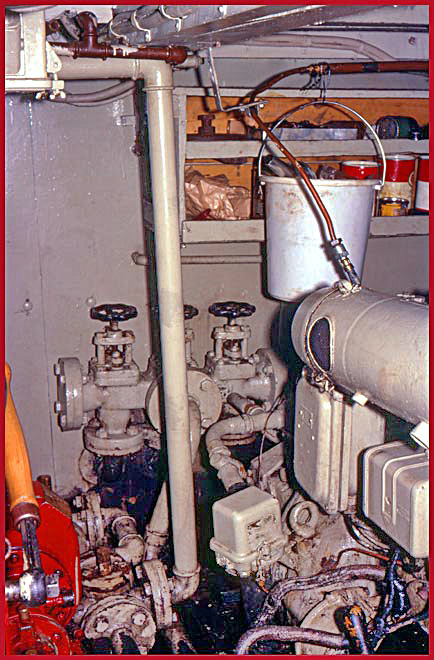
SKA 4 engine room - looking aft - (Photography by Karsten Petersen ©)
")
Peter, - the Cook -, with fresh caught dinner (Photography by Karsten Petersen ©)
")
SKA 4 at anchor at a small island (Photography by Karsten Petersen ©)
The purpose to drop the anchor there, was to establish a transmitter on a known position, - the island -, so that the SKA boats could determine their positions in relation to that transmitter, when they later on sailed up and down along pre planned lanes while taking echo sounder measurements of the sea bottom.
In that way it was possible for the boats to plot their positions, - with corresponding depth measurements -for use in future charts.
This sounds terribly complicated and difficult, - and it is -, when compared to modern day's satellite navigation systems where you anywhere and any time can see your exact position and track plotted directly on a computer screen - - -
")
Landing batteries and a portable generator on a small island (Photography by Karsten Petersen ©)
This is the hardest part of the job - - -
These batteries are lead/acid batteries and VERY heavy, - to put it mildly -, and handling them in a small rubber boat is a nightmare, which actually gets worse, when they have to be landed on the very slippery rocks - - - a true wonder that we did not loose any of them - - -
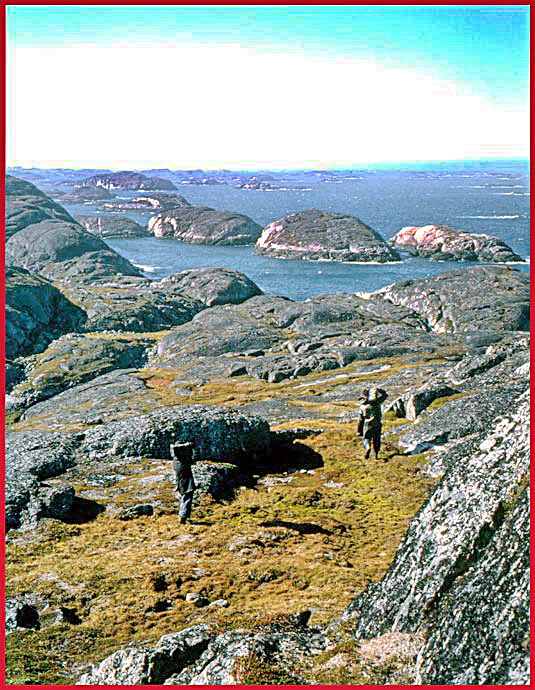
Then comes the VERY exhausting work of transporting these batteries and other equipment up to the very top of the island, which have no steps and no roads, but only steep rocks all the way up - - - -
The previous picture shows the view from the top of the island, and gives a good impression of the terrain and how hard it necessarily must be to climb up there with a heavy load on your back - - -

The signal transmitter, - a "raydist" station -, is established Jørgen, - the electronic wizard -, is trying to get it going - This one would be referred to as "red station", - see the red wires spread out from the base of the main antenna - (Photography by Karsten Petersen ©)
When finished, - the "raydist" station has to be dismantled again and everything has to be brought back to the boats.
Here is what it looks like when a couple of hard working navy boys carry the heavy lead/acid batteries down from the top. (Photography by Karsten Petersen ©)
Now please go to page 3 in this series about what it looked like in 1968, - when parts of the waters around Greenland was meassured and surveyed with the noble purpose of making charts to show safe shipping lanes around Greenland - - -
A VERY hard job, - but what an adventure it was to go to unknown places where nobody had been before - - -